

(14/6/2018 – 20/6/2018)
We left Hamelin Outback Station in the morning and travelled west along Useless Loop Road to Tamala Station where we had booked for 4 nights. It was a very long drive travelling on sealed and dirt roads to the Tamala Homestead to check in and after letting the tyres down it was a another slow and sandy 15 or so km drive onto the beach. So many people raved about “Tamala Station” and it did not disappoint!!!
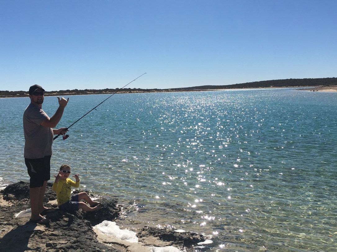
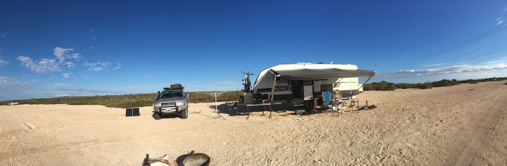
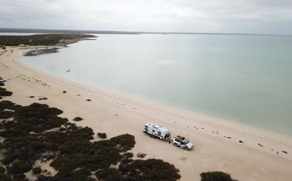
Tamala Station is part of the Shark Bay World Heritage Area. It’s a very popular area for beach camping, swimming, fishing and 4WD exploring!!!! There are many areas to camp at and we stayed at ‘Tea Tree East’. To stay here you have to be completely self sufficient and it was $34.00 per night (2 adults, we didn’t pay for Mitch), The weather was warm and sunny whilst we were there. It was a great spot for kids in that the waters were very calm and perfect for swimming (hmmm, if it wasn’t so cold!! well, for me it was LOL). There were only a few other campers on this long stretch of beach.
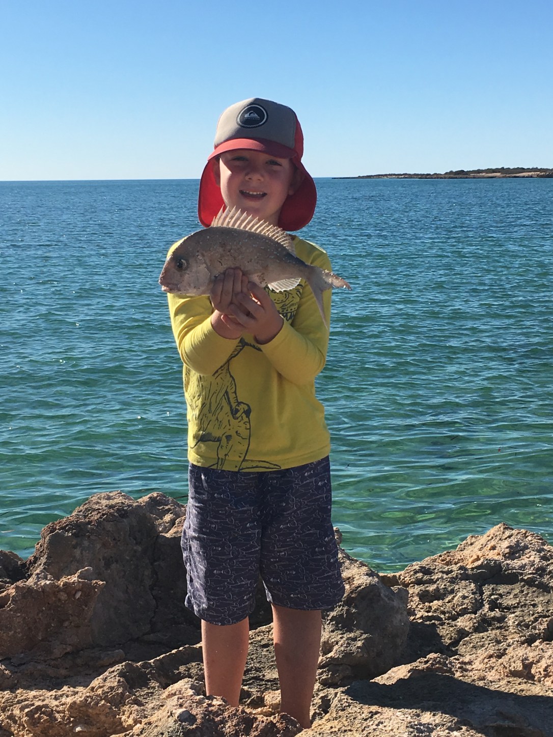
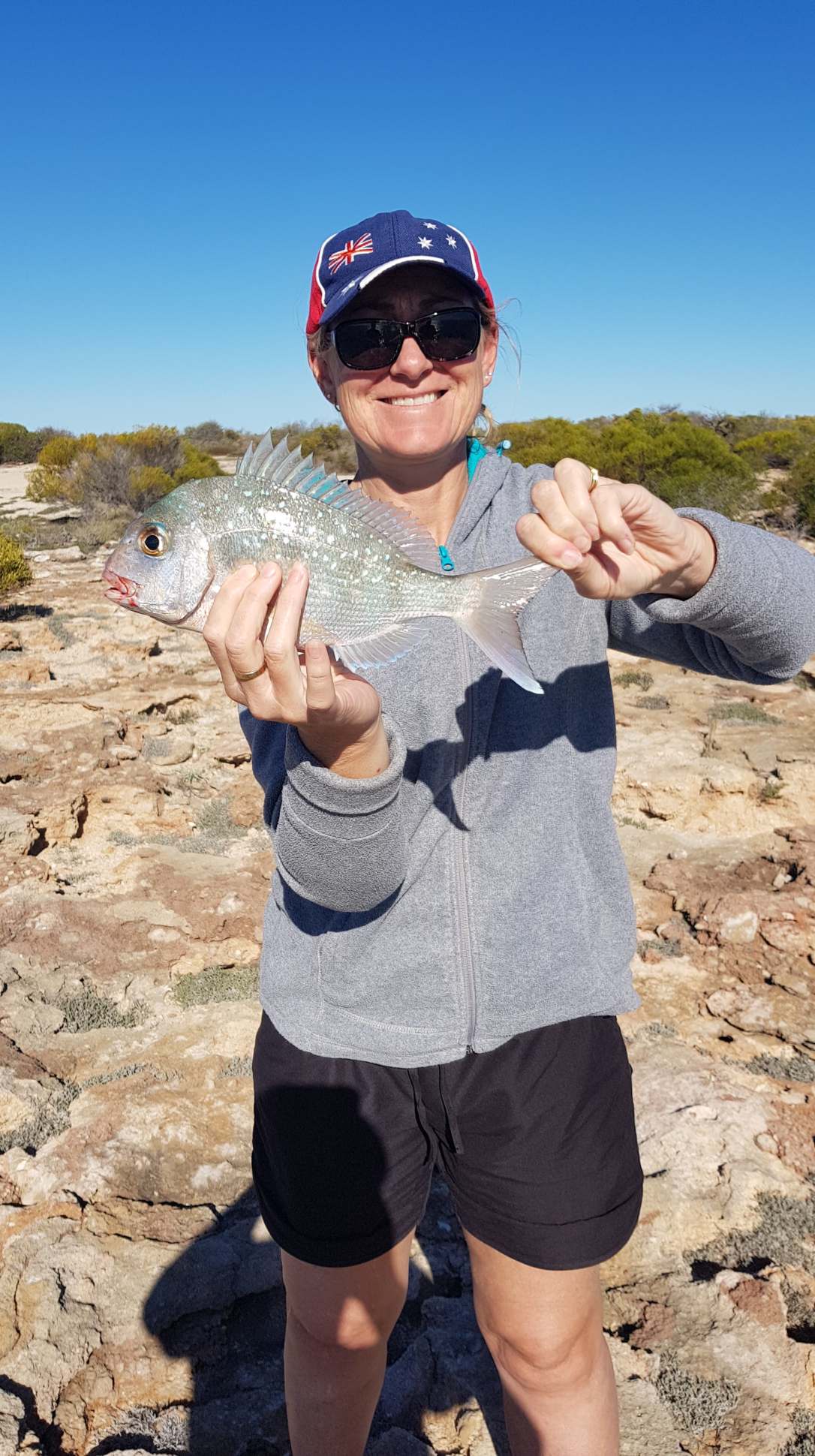
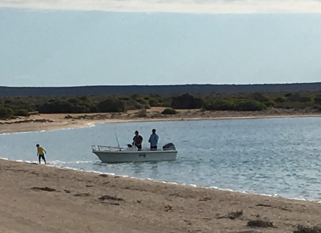
We met up with one family who I had seen on Facebook called the Blonde Nomads so we had drinks with them a couple of nights. We spent the next few days just relaxing by the water, exploring the area and of course fishing!!!! Andrew was also lucky enough to meet one of the campers there who had a boat so he took Andrew out fishing one evening.


Very lucky to see this Dolphin swimming around right in front of our camp!!!!
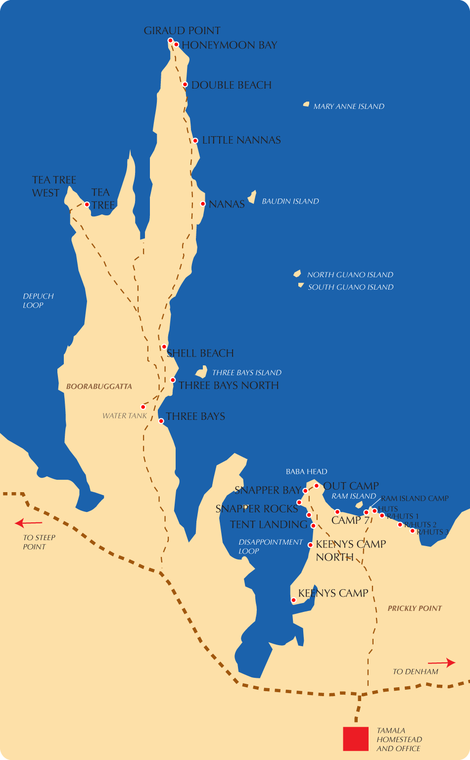
Tamala Station – Tea Tree East
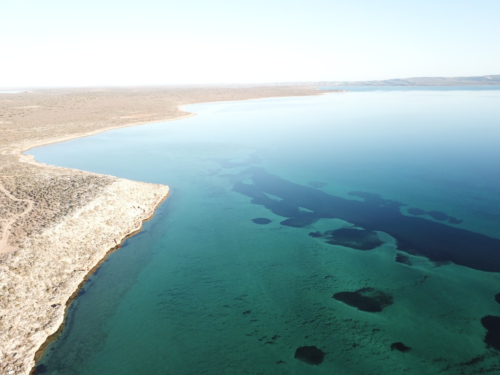
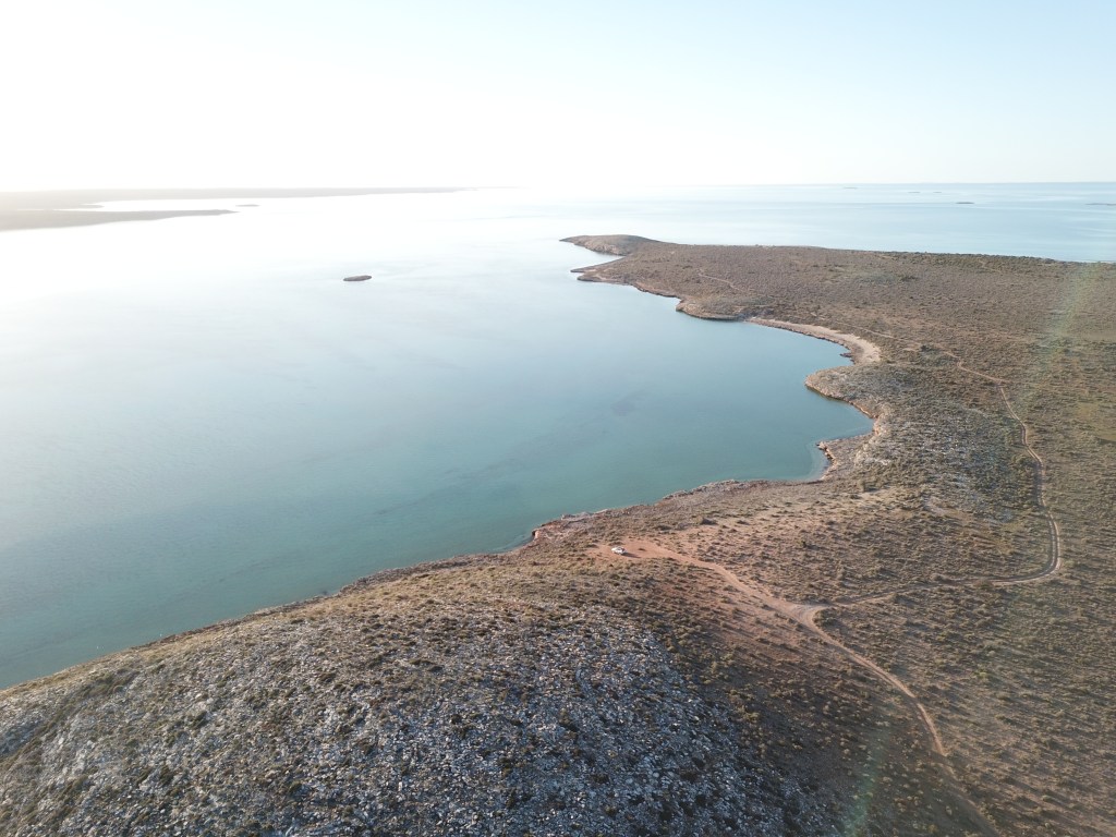
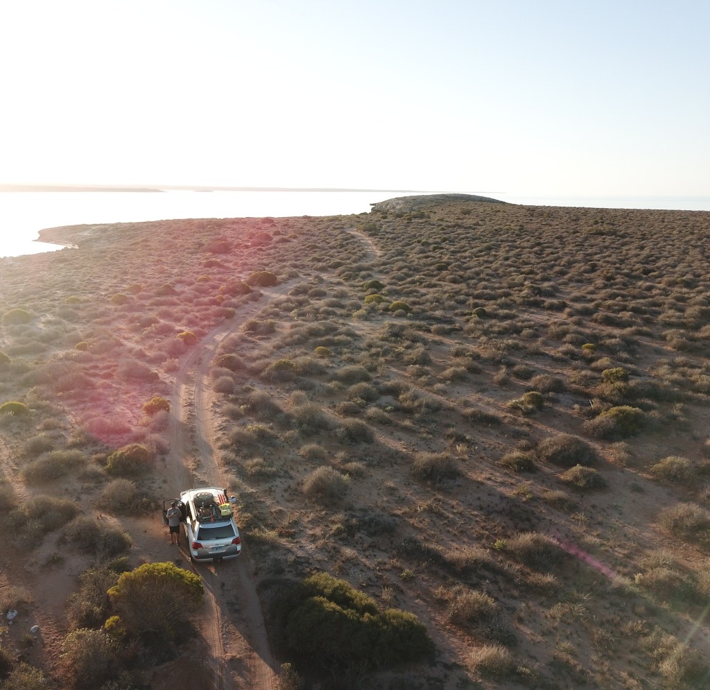


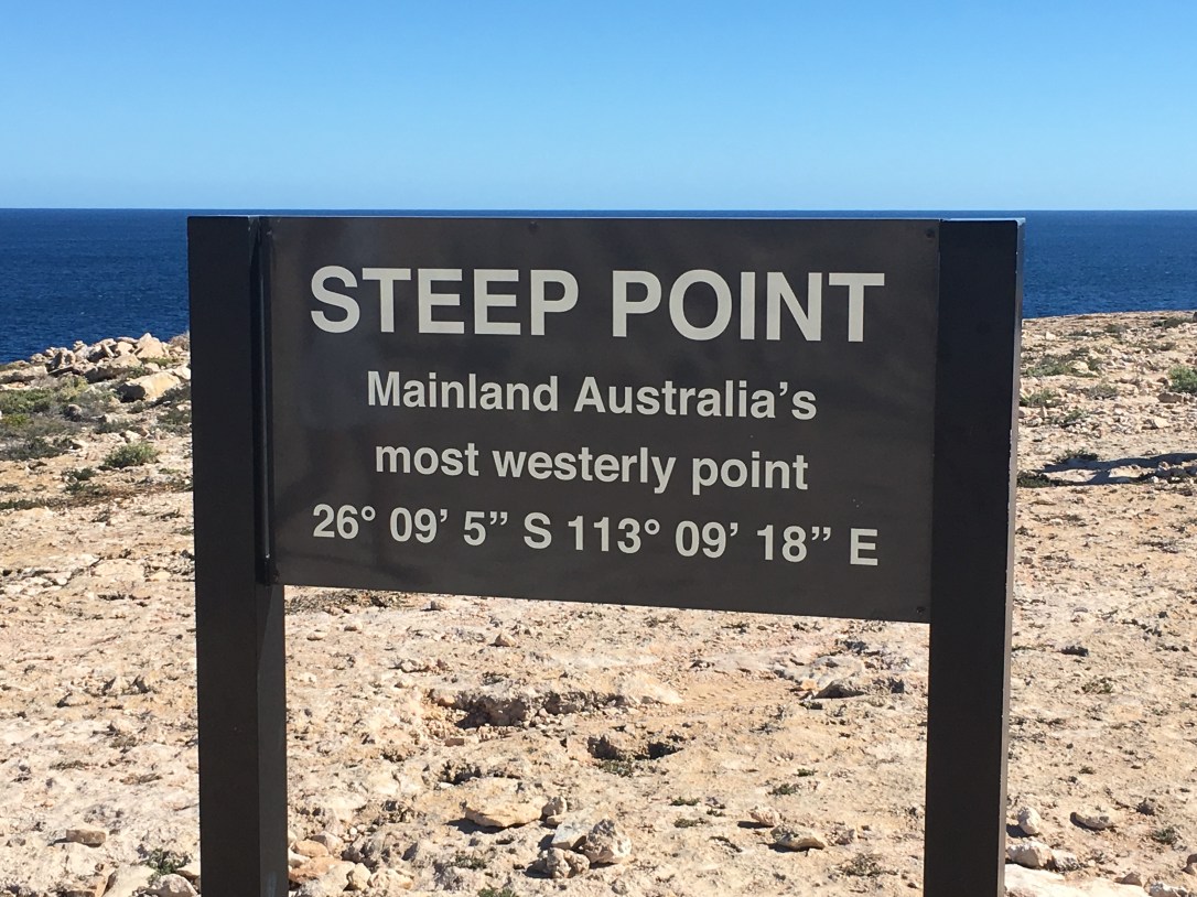
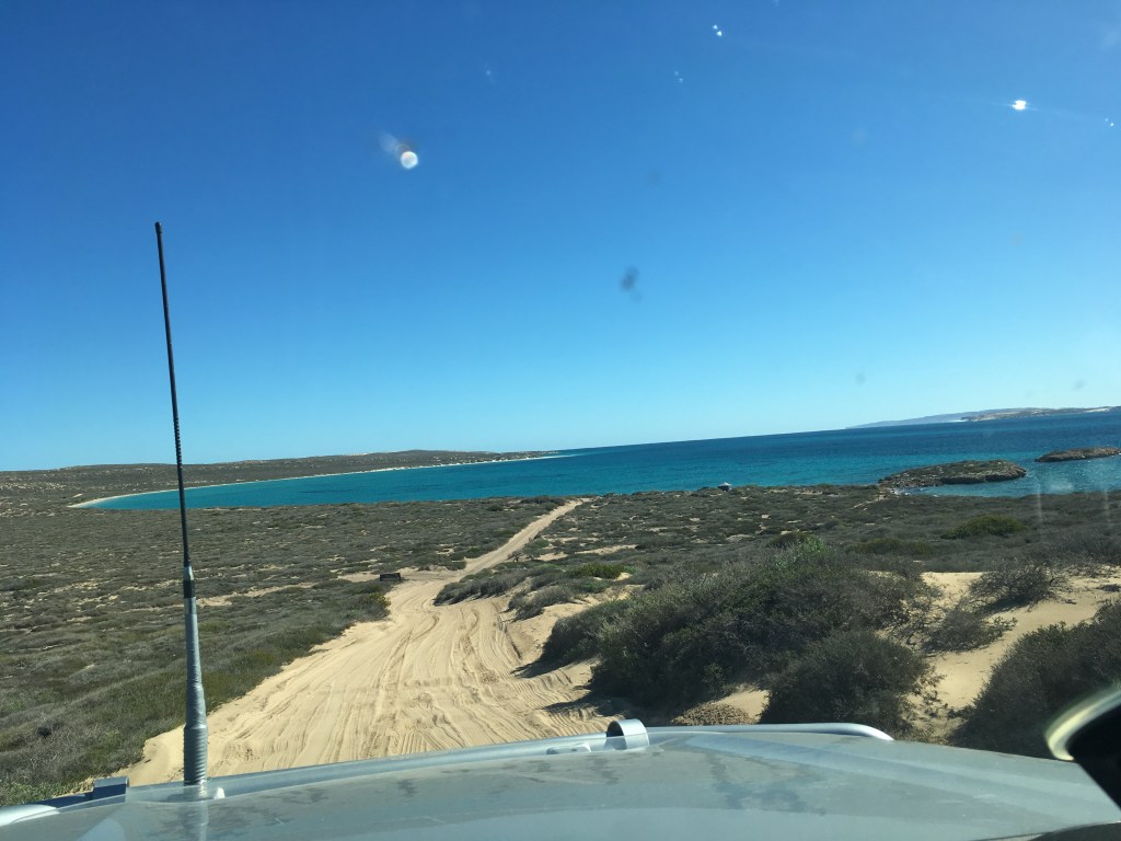
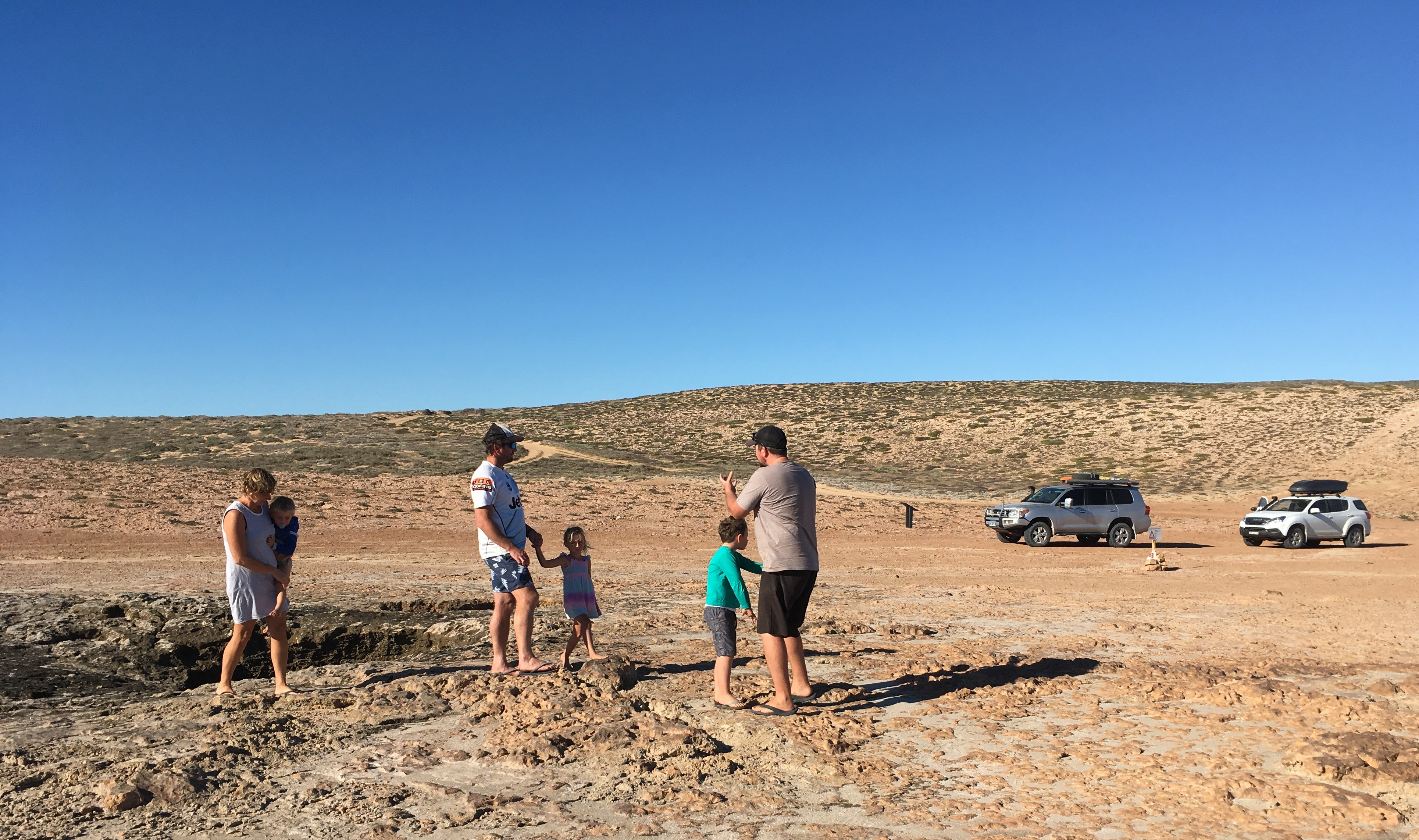
On one of the days we met up with Daniel and Stacey early in the morning and we drove out to Steep Point. What a massive 4WD adventure that day!!!! So much fun and the coastline was just awesome!!! My photos don’t do the scenery any justice. Andrew tried his luck at fishing, again, no luck, again.
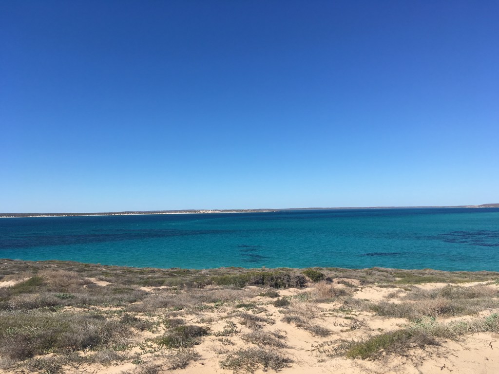
Steep Point is the most westerly point on mainland Australia. Steep Point can only be accessed by high clearance 4WD vehicles or by boat. There’s about 140 km of unsealed road and the last 30 km is a single lane of soft track winding around sand dunes. In 1697, the Dutch seafarer Willem de Vlamingh named the most westerly point of the Australian mainland “Steyle Hock”, or Steep Point in English, when he anchored off the limestone cliffs near the southern tip of Dirk Hartog Island.


A couple of shots of Steep Point from the Drone


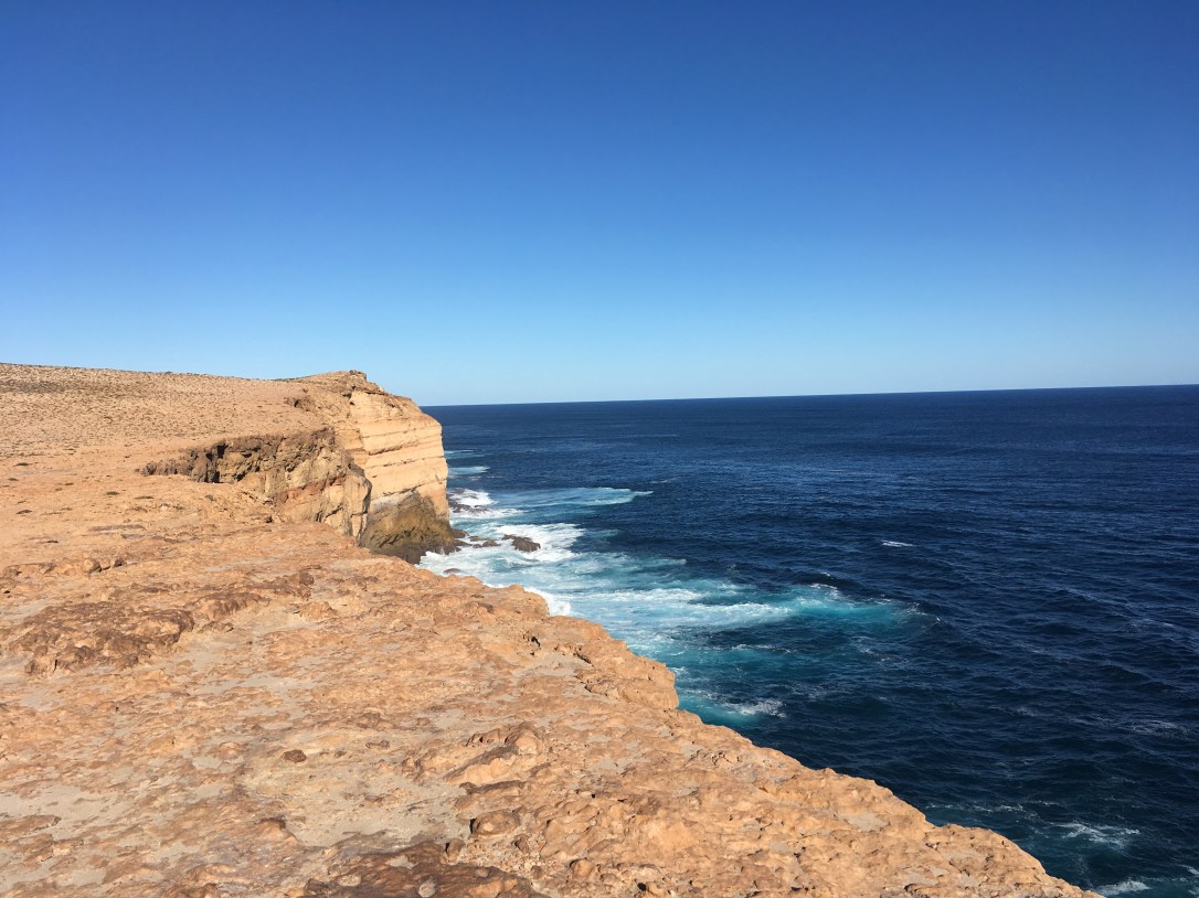
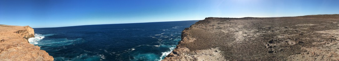
We then left Steep Point and travelled south along side the Zuytdorp Cliffs to the False Entrance Blowholes. These cliffs were named after the Dutch ship, the Zuytdorp which was ship wrecked against the base of the cliffs back in 1712.
Along the coastal cliffs erosion holes in the limestone come to life when the swell starts to run. ‘Blowholes’, as they are commonly known, are formed by years of pounding surf, which has eroded its way up through the cliffs to the surface. When large waves hit the coast the water surges up through these holes and is forced out, sometimes with enormous power, to form a plume of seawater and mist that can be tens of metres high.
Well, that was not the case today, we managed to see a little spray of mist about 1 metre or so high!!!!

From here we travelled back to our beach camp. We had another day of chilling out and fishing before we packed up on Monday morning to drive up to Carnarvon. The weather changed for the worse and started to rain so it worked out well we were leaving and getting back on the road travelling. We had 3 nights at the Coral Coast Tourist Park (stay 3 pay 2) before meeting up with Daniel and Stacey again at Ningaloo Station. We had already made a booking there but I wished we had more time to look around Coral Bay. Never mind, another reason to return………….
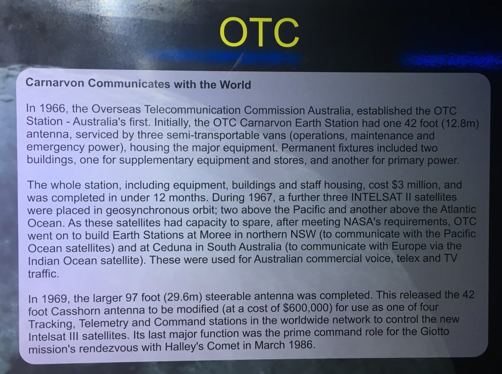
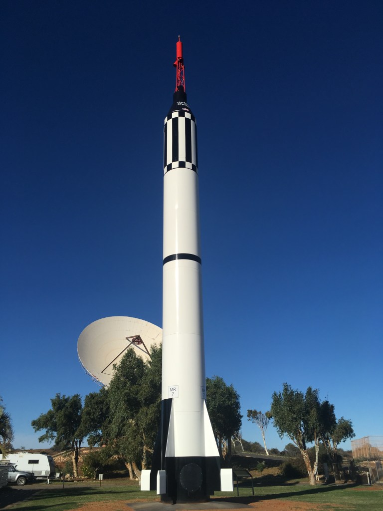
Whilst we were in Carnarvon we spent some time at the Carnarvon Space and Technology Museum. The museum focusses on two parts, the Carnarvon Tracking Station and the OTC Satellite Earth Station, for which each station played separate roles in the early space industry. We paid $25.00 entry.
The tracking station was built to support NASA’s Gemini, Apollo and Skylab programs. It was commissioned in 1964 and operated for 11 years. It was the last station to communicate with the space capsules leaving the earth orbit, and the last to make contact before splashdown in the Pacific Ocean.
The OTC Satellite Earth Station was opened in 1966, initially with the 12.8 metre wide Casshorn antenna as part of the global satellite communications system.
On 21 July 1969, the day of the Apollo 11 moon landing, the Casshorn antenna relayed Neil Armstrong’s first steps on the Moon from NASA’s Honey Suckle Creek Tracking Station to Perth’s TV audience via Moree earth station – the first live telecast into Western Australia. Later in 1969, the larger 29.6 metre wide steerable antenna was built to facilitate better communication between the NASA Tracking Station and the USA.
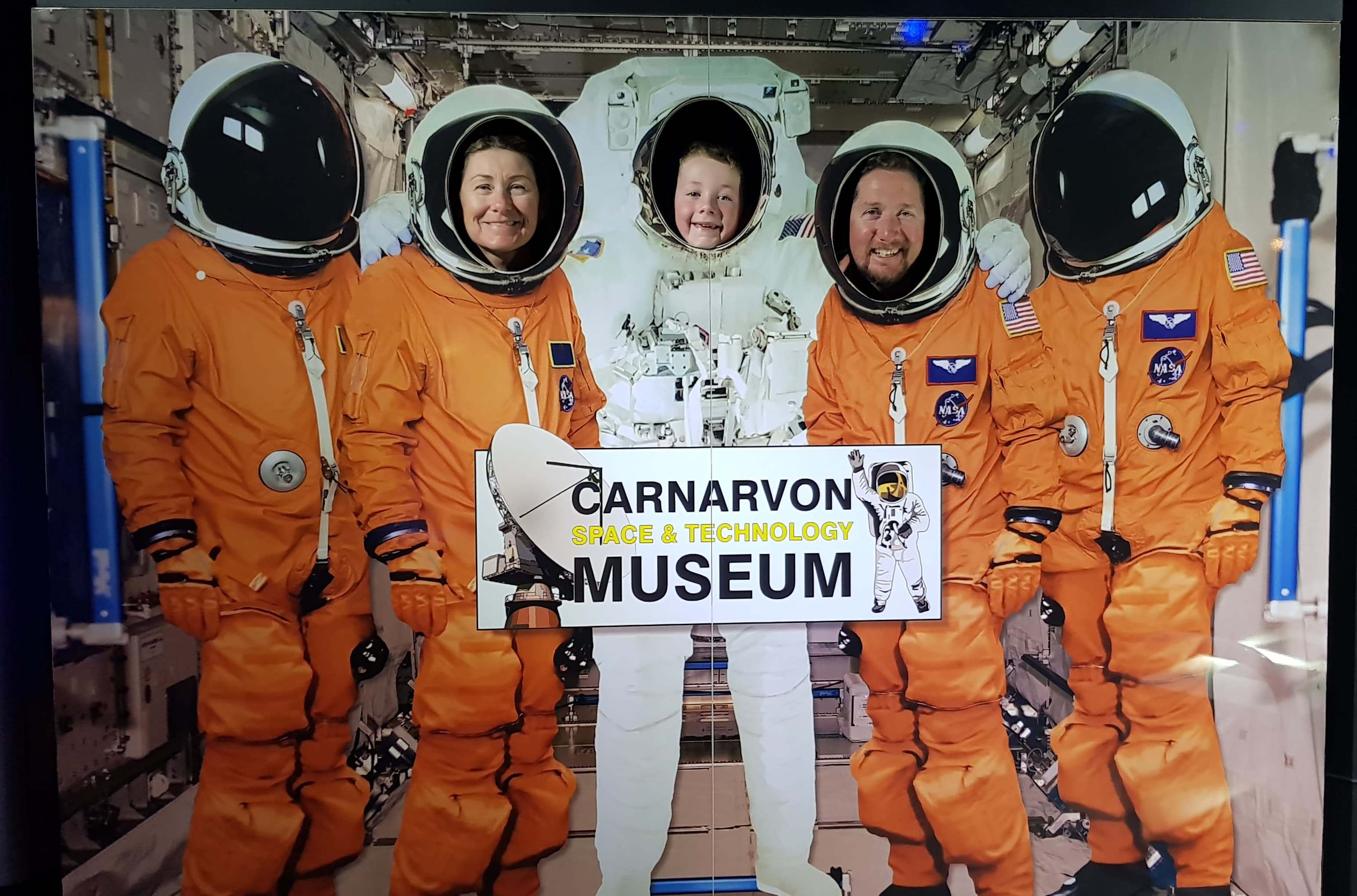
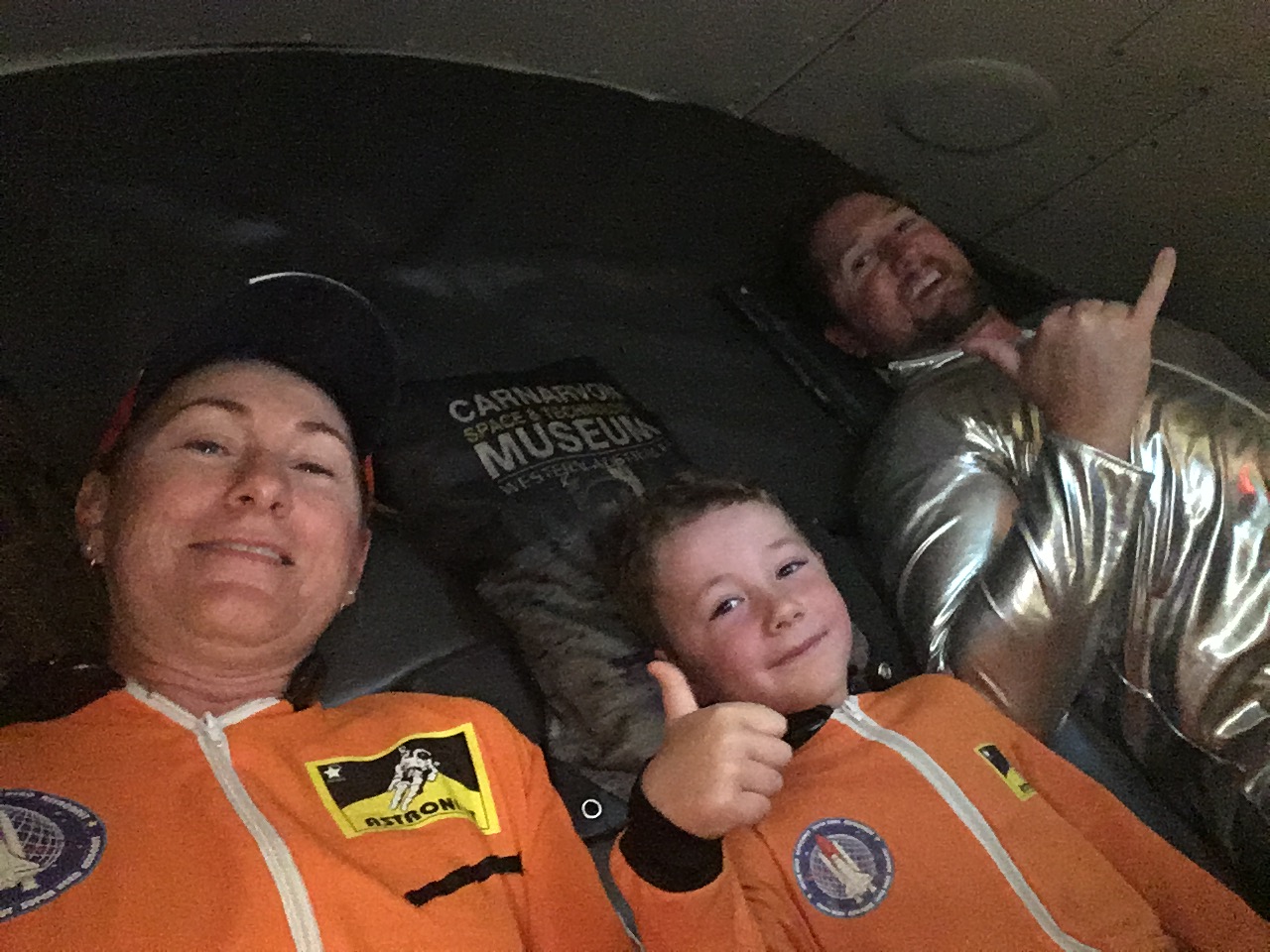
It was a very interesting day out with museum displays of Skylab, OTC, and NASA memorabilia along with interactive displays for the kids. They even had a full size Apollo capsule where we got dressed up in space suits and sat in the capsule for a real life experience of a Saturn V launch. The capsule shakes and rattles while you “take off”.
Another interesting fact we discovered is that Carnarvon was the first place in Australia where Bananas were grown!!!!


We left Carnarvon and headed north towards Ningaloo Station crossing the Tropic of Capricorn on the way. I read that once you reach the Tropic of Capricorn (which is between Carnarvon and Exmouth) and above, the seasons change; you no longer have four seasons, you have two: the dry season (April – September inclusive) and the wet season (October – March inclusive).

(14/6/2018 – 20/6/2018)
